Mid-West GIS will create additional GIS & GPS data sets for Argonne National Laboratory

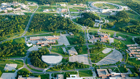
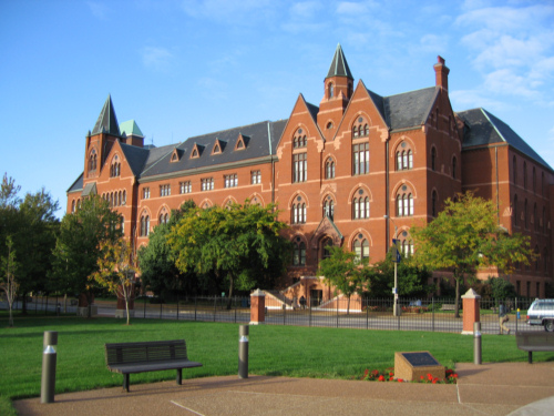
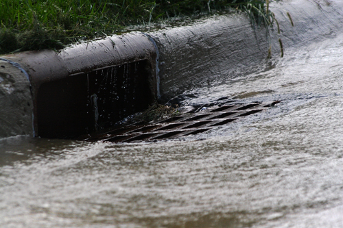
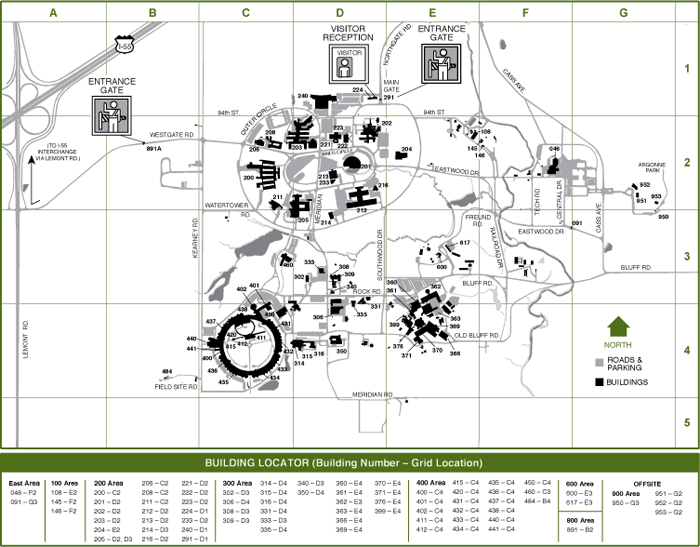
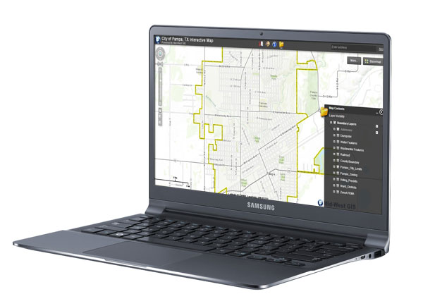
Argonne National Laboratory in Lemont, Illinois has just extended the contract for Mid-West GIS to create GIS & GPS data sets for both Communications and Sewer layers. The communication layers will include telephone and fiber optic layers. The sewer layers will include sanitary, storm and lab sewer layers. Data will be collected using Real Time Kinematic (RTK) GPS with sub-centimeter accuracy. For more information on this type of data collection, please visit our GPS Data Collection page, or contact us for more information.

argonne-national-laboratory-aerial

St Louis University has contracted with Mid-West GIS for Utility Mapping & GPS Training Services

St Louis University has contracted with Mid-West GIS for Utility MappingGPS Training Services. Mid-West GIS will be tasked with setting up their GPS equipment, and training St Louis University personnel on the operation of collecting GPS data and importing this data into ArcMap. Mid-West GIS will also collect meter locations using Real Time Kinematic GPS, giving sub-centimeter accurate locations. For more information on this type of data collection please visit our GPS Data Collection page.

Learn More Request An Estimate!

St Louis University

Mid-West GIS has relocated our corporate office in Quincy, IL to 526 South 8th Street.

Mid-West GIS has relocated our corporate office in Quincy, IL to 526 South 8th Street. The new locations was purchased in January and renovated to meet our growing companies needs. The space includes 2500 square foot office space, 1400 garage, and is located in the German Historic District and original Quincy Business District.  For more information or to see a map of the new location please visit our Contact Page.

office2

Phase III of the Portage, Indiana Storm Sewer mapping project has been approved

Phase III of the Portage, Indiana Storm Sewer mapping project has been approved and will move forward immediately. This project entails the collection of all storm sewer features using Sub-Centimeter accurate GPS equipment, also known as Real Time Kinematic (RTK) GPS Collection. Storm sewer manholes are also opened and inspected for items such as depth and flow direction. This phase of the project will complete the entire system which will be used by the Public Works Department for daily maintenance work.

Learn More Request An Estimate!

Indiana Storm Sewer mapping project

Argonne National Laboratory has contracted with Mid-West GIS to create GIS data layers for both their Steam Distribution System and Building Footprints.

Argonne National Laboratory has contracted with Mid-West GIS to create GIS data layers for both their Steam Distribution System and Building Footprints. Both data layers will be collected in the field using Real Time Kinematic (RTK) GPS equipment, as well as the conversion of existing GIS and CAD data. Argonne National Laboratory is a multidisciplinary science and engineering research center located in Lemont, Illinois. This project is expected to start immediately and be completed in the Fall of 2014.

Learn More Request An Estimate!

Argonne National Laboratory has contracted with Mid-West GIS to create GIS data layers for both their Steam Distribution System and Building Footprints.

GPS field inventory of the electric distribution system for Argonne National Laboratory

Mid-West GIS has begun work on the GPS field inventory of the electric distribution system for Argonne National Laboratory in Lemont, Illinois. This project will include the GPS collection of around 1,000 electric utility pole locations, as well as all of their associated assets. Some of the attachments and attributes that will be collected are; transformers, fuses, guy wires, pole height, line phases, and other features. Digital photos of each utility pole will also be collected and hyperlinked to the GPS data. Real Time Kinematic (RTK) GPS data collectors will be used for this project. This type of data collection will provide sub-centimeter accuracy for each point. For more information on this type of work please visit our Electric Distribution GPS Data Collection Services Page.

argonne-national-laboratory-aerial

Mid-West GIS Recently Launched Their New Interactive GIS Map!

Mid-West GIS has just released the new version of the Pampa, Texas Interactive GIS Map. In 2007 Mid-West GIS began the development of over a dozen GIS data layers for the City of Pampa. Once the GIS system was deployed and in use by the city, Mid-West GIS began work on taking the GIS System to the web. The plan was for the new site to be used by not only city staff who needed to view GIS data for their work related tasks, but for citizens to have the ability to view and use the data as well. In 2008 the first version of the website was released. Over the next six years there have been updates and changes to the Pampa GIS website as new features were added, software and hardware solutions were updated or changed, and  server solutions were upgraded. Today we have launched the most recent version of the interactive map. The new site offers more functionality, is much quicker, and more user friendly. You can see the new interactive map by visiting http://www.maps.cityofpampagis.org/ and if you have any questions on our Web Solutions Page or Contact Us for more information and pricing.

laptop-gis

Mid-West GIS has completed Phase II of the Portage, Indiana Storm Sewer Mapping Project.

Mid-West GIS has completed Phase II of the Portage, Indiana Storm Sewer mapping project. Field collection is completed for over 4,000 surface features using Real Time Kinematic (RTK) GPS, which delivers sub-centimeter accurate GPS data. The data collection includes features such as storm inlets and manholes, including the invert elevations. This project is being done as part of a joint effort with The Sidwell Company out of St Charles, Illinois. Phase III of the project, once approved, would be the completion of the field collection for the entire storm sewer system.

GPS data collection

Mid-West GIS Attends The Contractor Safety Orientation (CSO Training) at Argonne National Laboratory

Shane McDermott, Joe Darnell, and Brian Hollenkamp attended the Contractor Safety Orientation (CSO Training) at Argonne National Laboratory in Lemont, Illinois on June 17, 2014. Safety training is mandatory for any personnel entering the Argonne facility. Argonne is committed to a safety first policy, and the implementation of safety protocols by all contractors is crucial to maintaining a safe working environment. With our personnel in the field collecting utility data, in areas with high pedestrian and vehicle traffic, Mid-West GIS is always reminding staff and sub-contractors of the importance of following not only OSHA regulations, but those of our clients and local agencies.

Argonne National Laboratory

New Case Study: Electric Distribution System for Hannibal Board of Public Works

Mid-West GIS was contracted by the Hannibal Board of Public Works in 2012 to do a complete field inventory and update existing GIS data for their Electric Distribution System Utility Database. This included over 350 miles of line and 9,455 utility poles. The data had already been converted into a geodatabase, but needed field verified as well as additional data added that was missing.

View The Case Study Request An Estimate!

electrical-distribution-field-inventory